

Water Resources Research
Do you want to know if there is water in your land? In recent years, artesian wells have been drying up due to drought and therefore surface aquifers do not become loaded with water. At Hydro Hunter we non-invasively search for deep aquifers that are able to cover large water needs.
The Poseidon technology invented by Sergio Marchettini (a regularly patented machine) combined with the professionalism and the idea of the helicopter pilot with over 35 years of flight between the Army, State Police and now pilot of the 118 air ambulance, Vincenzo Orso a unique service.
By exploiting the principles of electromagnetism, through a probe that is mounted on a drone, which flies over large quantities of ground, the electromagnetic waves generated at very low frequency penetrate deep into the ground up to 200 meters (up to 1800 with additional equipment in support of the cited technology) hitting everything they encounter. Each difference in density of the soil layers corresponds to a response that goes back to the surface, electromagnetic anomalies, which are captured by the drone which through a Bluetooth signal sends data to the machine which in real time, by making points appear on the map, highlights electromagnetic anomalies present on the ground.
In these marked points, there is a very high possibility of finding water and therefore with a car attached to the wall, an inspection of the points indicated is carried out to perform an orthogonal magnetic resonance of the ground. In practice, every 3 meters a signal is sent that reaches up to 200 meters deep and then comes back. This operation is carried out along a corridor of about 1.50 – 1.80 cm in width and 100 meters in length in order to obtain a colored graph on ordinates (meters of depth) and abscissas (meters traveled on the walking surface) where it is possible to understand where there are water resources (success rate ranging from 80 to 90% depending on the nature of the land).
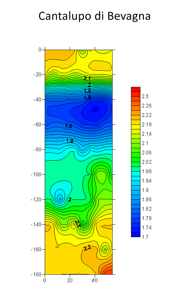
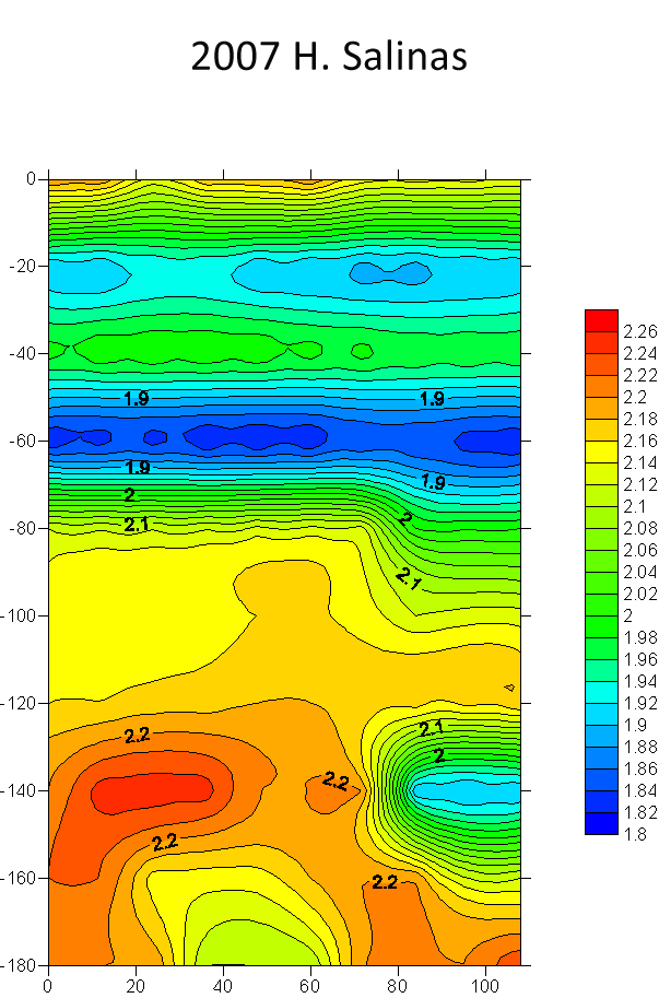
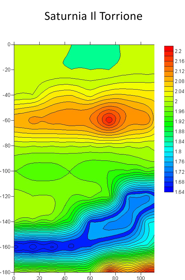
In this scheme it is easy to understand from the color scale that the magenta / red colored soil is the hardest (rock type). The green and yellow color can be sand or clay, the blue gravel or wet sand and clearly the dark blue denotes the presence of water.
Before carrying out this operation in order not to make potential customers make incorrect investments, we request the geographical coordinates and the extension of the land to carry out a preliminary analysis on our hydrogeological and geophysical maps to evaluate the probability of finding aquifers or paleo-riverbeds (ancient stretch of riverbed of a watercourse no longer connected to a river).
Once there is a good chance of finding water, the intervention is carried out, to cover an area of 50 hectares it takes about 4 hours of work, while for the electronic processing for the realization of the graph it takes about 2 working days. . Once the work is finished, the customer is given a technical report to be provided to any drillers.
In daily operations, the most requested services are the search for aquifers for irrigation purposes or for preventive purposes in the case of new buildings, in the case of suspected hydrogeological risk.
CAPE VERDE ISLA DE SAL


There are major water shortages in the island state of Cape Verde in Africa. Through the work carried out by Hydro Hunter, 24 aquifers were found on 25 searches for the construction of future water wells for the population.